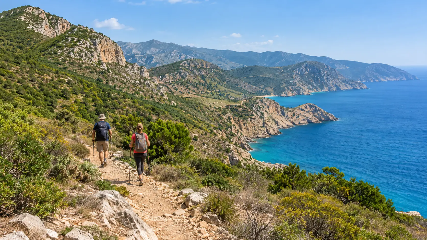
Al Hoceima National Park hiking is less about following one famous loop and more about choosing the right section of a large, rugged coastal landscape. West of Al Hoceima city, the protected area combines Rif mountains, limestone cliffs, dry valleys, Amazigh villages, Mediterranean coves and a substantial marine zone.
For a first visit, the most practical approach is to choose one sector, arrange your trailhead and return transport before setting out, and avoid trying to cross too much of the park in one day. Routes around Taoussart, Adouz, Tikkit, Bades, Torres and Cala Iris offer different combinations of coastal views, village paths and steep descents toward the sea.
The park is a genuine hiking area rather than a fully standardized trail center. Some routes are established and signposted, while others use natural paths, tracks and village connections. Conditions can change, so confirm the route locally if your hike depends on a particular path, beach descent or pickup point.
What Hiking in Al Hoceima National Park Is Like
Al Hoceima National Park was established in 2004 and protects both terrestrial and marine environments. It is also recognized as a Specially Protected Area of Mediterranean Importance, reflecting the ecological value of its coastal habitats.
On land, the landscape is strongly shaped by the Bokkoya massif. Trails and rural tracks cross hills covered with Mediterranean scrub, carob, wild olive, palms, figs and aromatic plants before reaching cliffs or small coves.
The hiking character changes quickly. A route can begin on a broad rural track, narrow into rocky terrain, cross a dry valley and then descend sharply toward the coast. Shade may be limited, and distances that look modest on a map can feel considerably harder once repeated climbs and descents are included.
This makes the park better suited to travelers who are comfortable planning around terrain rather than simply counting kilometers.
Al Hoceima National Park Hiking: How to Choose a Route
It helps to think of the park in sections rather than searching for one definitive “Al Hoceima National Park trail.”
Taoussart, Tafensa and Adouz
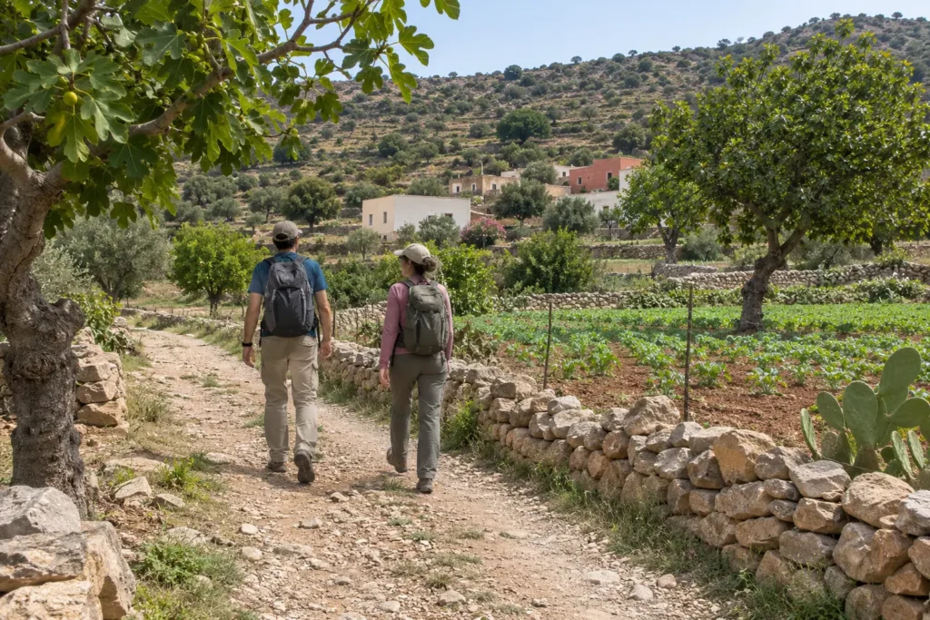
The eastern and central side of the park is useful for travelers who want to combine hiking with village landscapes and access to coastal coves.
Routes around Tafensa, Taoussart and Adouz pass through rural settlements, cultivated areas and Mediterranean vegetation before approaching the cliffs. Adouz sits inland on higher ground, while several paths descend toward the coast.
Taoussart is associated with one of the park’s well-known beach descents, commonly described as the “700-step beach.” The exact number is less important than the practical point: reaching some coves involves a substantial descent that must be climbed again unless you have arranged a different finish.
Before relying on any beach staircase or path, check its current condition locally. Erosion, maintenance and weather can affect steep coastal access more quickly than urban walking routes.
Tikkit and Nearby Coves
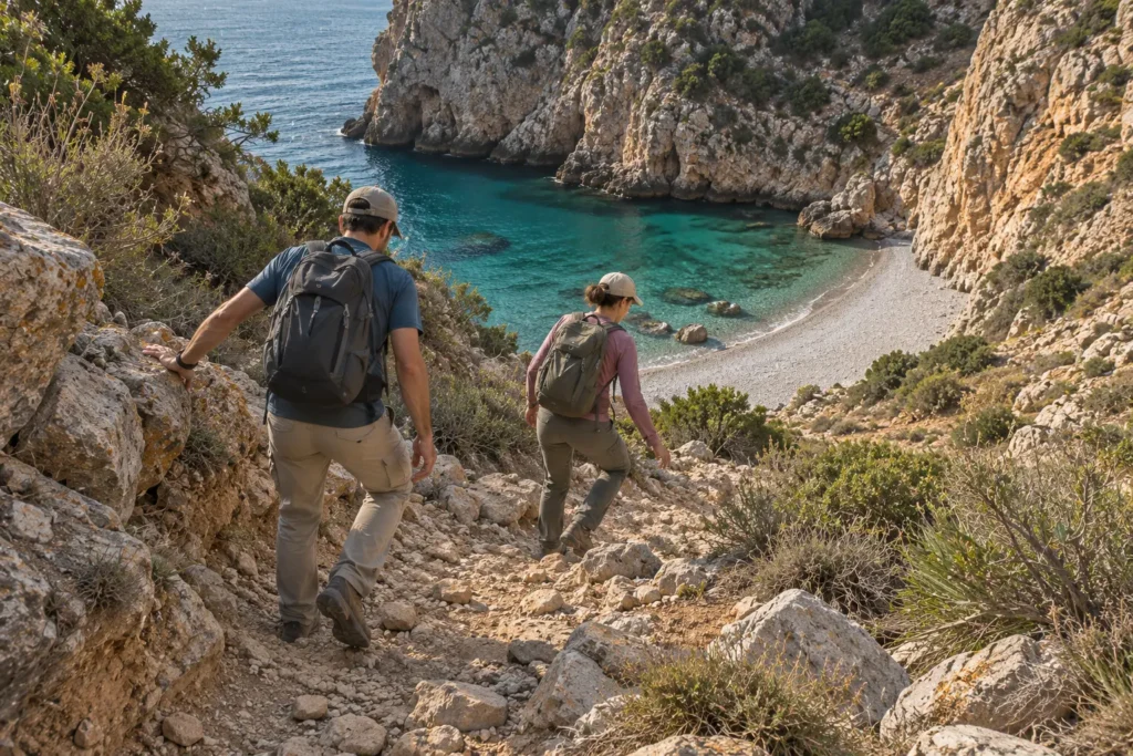
Tikkit is a good example of why hiking in the park should be planned around terrain. The cove lies below rugged hills, so reaching the coast can involve rocky sections and a noticeable descent.
It suits hikers who want the beach to be the destination rather than an incidental stop. Build enough time into the day to rest before climbing back out, especially in warm weather.
If you plan to swim, make that decision from the sea conditions you find on arrival. Remote coves should not be assumed to have lifeguards, changing facilities, drinking water or an easy alternative exit.
Bades to Torres
The western side of the park contains one of its most useful point-to-point coastal walks. A current ecotourism route between Bades and Torres covers roughly six kilometers, following the coast through a landscape of cliffs, rural paths and views over the Mediterranean.
This is a manageable distance for many regular walkers, but the terrain matters more than the number alone. Rocky sections, elevation changes, exposure to sun and the need to organize transport at the far end all affect the difficulty.
Bades adds historical interest to the hike, while Torres has coastal scenery and the remains of a fortified site above the village.
Because this is naturally suited to a point-to-point walk, decide before starting whether someone is meeting you, a taxi has been arranged, or you are prepared to retrace the route.
Cala Iris to Bades
Longer coastal options extend through the western park. Recent local hiking routes describe a Cala Iris to Bades trail of around 12 kilometers with repeated climbing and descending above the Mediterranean.
This is better treated as a substantial hike rather than a casual beach walk. The route is exposed, shade is limited and the finish is away from the starting point, so return transport should be part of the plan.
Travelers who want the scenery without committing to the entire route can instead choose a shorter out-and-back section from one end.
How Much Time Should You Allow?
A short hike can fit into half a day if your trailhead is easy to reach and you are not descending to a remote beach. For most visitors, however, a full day gives the park more breathing room.
Allow time for:
- Reaching the correct trailhead from Al Hoceima or your accommodation.
- Finding the beginning of the route rather than assuming it will be obvious from the road.
- Climbing and descending on rocky terrain.
- Water and food breaks.
- Time at a cove or village without rushing.
- Unexpected route-finding delays.
- The return journey before dark.
Multi-day walking is also possible through the wider network of village routes and rural accommodation. If that is your plan, confirm current gîte availability and meal arrangements before leaving rather than assuming older accommodation listings still operate unchanged.
Do You Need a Guide?
No guide is required for every hike. Experienced hikers who have a clear route, reliable navigation and arranged transport can explore straightforward sections independently.
A local guide becomes more useful when:
- You want to link several villages or coastal sections.
- The trailhead or route is poorly defined.
- You are planning a point-to-point hike with transport logistics.
- You want to understand local ecology, history and village life rather than simply follow a track.
- You are attempting a longer or multi-day route.
A guide should not be used as a substitute for suitable footwear, enough water or realistic fitness. It is primarily useful for navigation, local context and adapting the route to current conditions.
Getting to the Trailheads
Al Hoceima city is the most practical base for travelers who want urban accommodation and access to several eastern sections of the park.
There is no need to assume every trail starts directly from the city. Many useful hiking areas lie around rural communities farther west, and reaching them normally involves road transport before the walking begins.
A rental car offers the most flexibility, especially when exploring Taoussart, Adouz, Bades, Torres or Cala Iris. Grand taxis can also be useful for reaching individual villages or arranging a drop-off.
For point-to-point routes, the return matters more than the outbound journey. Confirm where your hike ends and how you will leave before setting off. Do not rely on finding an unplanned taxi at a remote beach or rural trail finish.
If using your own vehicle, make sure the route returns to the same parking place or arrange a transfer between the two ends.
When to Hike in Al Hoceima National Park
Spring
Spring is one of the more practical periods for coastal hiking. Temperatures are generally easier for sustained walking than in high summer, while vegetation can be greener after winter rainfall.
Rain can still affect trails, however, particularly rocky descents and dry streambeds that become wet after storms. Check recent conditions if bad weather has passed through the area.
Autumn
Early and mid-autumn can also work well, particularly once the strongest summer heat has eased. Coastal weather remains variable, so plan for sun, wind and occasional rain rather than assuming stable conditions.
Summer
Summer is the main beach season around Al Hoceima, but it is not necessarily the easiest hiking season. Much of the park is exposed, and long climbs can become uncomfortable in strong heat.
If you hike in summer, start early, choose a shorter route and carry more water than you would for an urban walk. Midday is better treated as a time for rest rather than the hardest climb of the day.
Winter
Winter can bring quieter trails and cooler hiking conditions, but rain and wind become more important factors. Rocky paths can be slippery, and coastal conditions may make exposed sections less appealing.
Use the actual forecast and recent local information when deciding whether a route is suitable.
What to Bring on a Coastal Hike
- Sturdy footwear: Rocky paths, loose ground and repeated descents make hiking shoes more practical than beach sandals.
- Enough drinking water: Do not depend on finding water along rural or coastal sections.
- Sun protection: Bring a hat, sunscreen and clothing that gives useful coverage.
- Food or snacks: Some villages may have local shops or services, but availability should not be assumed on the trail.
- An offline route: Save your map or GPX track before leaving your accommodation.
- A charged phone: Useful for navigation and transport arrangements, while remembering that technology should not replace basic route awareness.
- A light extra layer: Wind along exposed cliffs can feel different from conditions inland.
- Swimwear only if relevant: Some routes reach coves, but swimming should remain optional and dependent on conditions.
Trail Safety on the Rif Coast
Coastal hiking here requires more judgment than walking along a maintained city promenade.
Stay away from cliff edges, particularly in strong wind or where loose ground has eroded. Avoid taking shortcuts down steep slopes just because the sea looks close on the map.
Start early enough that a slower-than-expected hike does not leave you navigating unfamiliar terrain after dark. If a route is taking substantially longer than planned, turning around can be the better decision.
Dry valleys and drainage channels also deserve caution after heavy rain. Conditions can change quickly in rough terrain even when the coast was dry earlier in the week.
If you are hiking alone, tell your accommodation or another person which route you intend to follow and when you expect to return.
Wildlife and Responsible Hiking
Al Hoceima National Park protects important Mediterranean habitats on land and at sea. Its coastal cliffs are associated with raptors including the osprey, while marine habitats support a wide variety of species.
Wildlife should be treated as a possibility rather than a promise. Do not approach nesting birds or leave the trail trying to obtain a closer photograph.
Responsible hiking also means:
- Staying on established paths where possible.
- Keeping away from cliff nesting areas.
- Taking all rubbish back out with you.
- Avoiding damage to shrubs, trees and coastal vegetation.
- Keeping noise low around wildlife and rural homes.
- Asking permission before photographing residents.
- Respecting crops, livestock and private land around villages.
- Supporting local guesthouses, guides and cooperatives when their services suit your trip.
The villages within and around the park are lived-in communities, not trail infrastructure. Walk through them with the same consideration you would expect in your own neighborhood.
Should You Combine Hiking With a Beach Stop?
Yes, when the route naturally reaches the coast. Tikkit, Bades and other coves make it possible to combine hiking with time beside the Mediterranean.
The mistake is assuming every hike should end with a swim. Some beaches have pebbles, limited shade or no facilities, and sea conditions can vary. Carry what you need and treat swimming as an optional extra rather than a guaranteed part of the route.
If your main goal is beach time rather than hiking, it may be more practical to drive directly to an accessible coastal area and save a longer trail for another day.
Common Al Hoceima National Park Hiking Mistakes
- Choosing a trail only by distance. Elevation, rocky terrain and exposure can matter more than the kilometer count.
- Starting without a return plan. Point-to-point coastal routes require transport planning before the hike.
- Underestimating summer heat. Many paths have limited shade.
- Assuming every beach has facilities. Bring your own water, food and sun protection.
- Trusting an old route description without checking conditions. Coastal paths can change through erosion, maintenance and local access arrangements.
- Trying to cover the entire park in one day. Pick one sector and enjoy it properly.
- Leaving the path for a better photograph. Cliff edges and wildlife habitat are poor places for unnecessary shortcuts.
FAQs
Is Al Hoceima National Park good for hiking?
Yes. The park has coastal trails, village paths, rugged hills and routes leading to Mediterranean coves. The main challenge is choosing a route that matches your fitness, transport plan and the conditions on the day.
Can beginners hike in Al Hoceima National Park?
Yes, provided they choose a shorter route and avoid difficult cliff or beach descents. A local guide can make a first visit easier when the route is not obvious.
Is the Bades to Torres trail difficult?
The coastal route is roughly six kilometers, but rocky ground, climbs, sun exposure and point-to-point logistics can make it more demanding than the distance suggests. Assess difficulty from current conditions as well as fitness.
Can you hike from Cala Iris to Bades?
Yes, a longer coastal route is used between Cala Iris and Bades. Current local route information describes it as roughly 12 kilometers with repeated elevation changes. Confirm the track and arrange return transport before starting.
Do you need a car for Al Hoceima National Park?
Not necessarily, but a car makes reaching rural trailheads and organizing point-to-point hikes easier. Grand taxis can also work when a drop-off and pickup are arranged in advance.
What is the best season for coastal hiking?
Spring and autumn are generally the most comfortable periods for longer walks. Summer can be very exposed and hot, while winter rain can make rocky or steep trails more difficult.
Choose One Section and Hike It Well
Al Hoceima National Park rewards travelers who plan around the landscape rather than trying to fit every beach and village into one day. Decide whether you want village paths around Taoussart and Adouz, a beach descent near Tikkit, or a longer coastal route around Bades, Torres and Cala Iris.
Once the route is chosen, arrange transport, carry enough water and leave time for the climbs as well as the views. For more outdoor ideas around Morocco, explore Visit Morocco Together’s Things To Do guides.
Ready to Experience Morocco?
Turn this inspiration into your next adventure. Our travel experts are ready to help.