Talassemtane National Park hiking trails offer some of northern Morocco’s most varied walking experiences, from riverside paths and waterfalls near Akchour to forested mountain slopes and challenging Rif summits. For travelers staying in Chefchaouen, choosing the right trail depends on available time, fitness, weather and the kind of scenery they want to explore.
For a first visit, the Akchour waterfall trails are the most flexible choice. God’s Bridge is a shorter but steeper alternative, while Jbel Lakraa, Jbel el Kelaa and Jbel Tissouka are better suited to hikers seeking mountain terrain. Experienced walkers can also consider longer routes connecting villages, forests and valleys.
The important distinction is that Talassemtane is not one continuous, easily navigated walking circuit. Different hikes begin at different trailheads, require different levels of preparation and cannot always be combined comfortably in a single day.
Why Hike in Talassemtane National Park?
Located in northern Morocco’s Rif Mountains, Talassemtane National Park protects a landscape of limestone peaks, deep gorges, mountain forests and traditional rural settlements. The park lies close to Chefchaouen and extends into the wider mountain region toward Tetouan.
Its forests include the rare Moroccan fir, a tree closely associated with this part of the Rif. Higher routes introduce hikers to a different environment from the popular river valleys, with rocky ridgelines, wooded slopes and extensive mountain views.
The variety makes Talassemtane appealing to different travelers, but it also means that a route described as moderate on a hiking map may feel demanding when steep climbs, loose stones or water crossings are involved.
How to Choose Your Talassemtane Hiking Route
Before selecting a trail, consider what you want from the day:
- For a shorter nature walk: Follow the Akchour river valley toward its smaller waterfalls and turn around whenever necessary.
- For a longer waterfall hike: Continue toward the upper Akchour waterfall, allowing more time for uneven terrain and possible stream crossings.
- For a natural rock formation: Choose God’s Bridge, which offers dramatic gorge scenery on a relatively short but steeper route.
- For forest and mountain views: Consider Jbel Lakraa, with its higher-altitude landscape and more substantial ascent.
- For a strenuous mountain day: Explore routes toward Jbel el Kelaa or Jbel Tissouka with appropriate navigation and preparation.
- For a longer trekking experience: Consider an Afeska-to-Akchour route or a guided village-to-village itinerary.
These descriptions are general planning guides rather than fixed difficulty ratings. Walking distances and times depend on the exact route, starting point, weather and conditions underfoot.
Compare Talassemtane National Park Hiking Trails
1. Akchour Lower Waterfalls: A Flexible First Hike
Best for: First-time visitors, casual hikers and travelers who want a manageable introduction to the park.
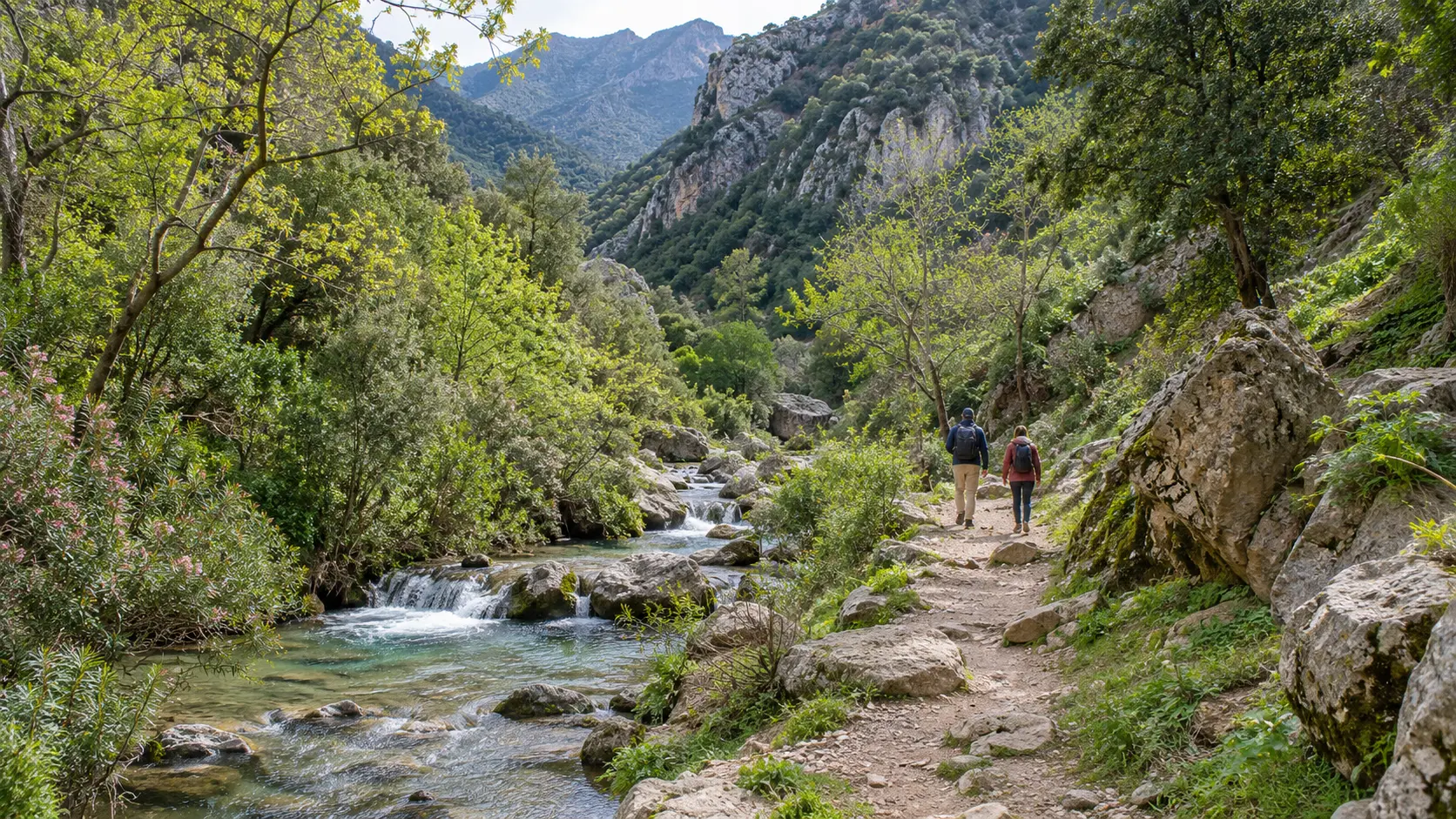
The lower waterfall route begins near Akchour, where paths follow the river into a limestone gorge. From the trailhead near the hydroelectric dam, the waterfall route branches away from the separate path toward God’s Bridge.
The first section passes running water, rocky pools and smaller cascades. Depending on the season, visitors may also encounter places to stop for refreshments.
This is a useful choice because it does not require committing to the farthest waterfall. Travelers can enjoy the river scenery, stop at a suitable viewpoint and return along the same route.
However, a shorter walk is not necessarily a completely easy one. The path has uneven sections, and rocks near the water can become slippery. Water levels may also change which crossings are practical.
Planning advice: Allow a few hours for walking and breaks rather than treating the lower waterfalls as a quick roadside attraction. This is the most adaptable Akchour option for visitors who prefer a slower pace.
2. Akchour Upper Waterfall: A Longer Gorge Adventure
Best for: Active walkers who want a substantial hike with waterfalls, river scenery and a clear destination.
Continuing beyond the smaller cascades leads deeper into the Akchour gorge toward the larger waterfall, often called the Grand Cascade.
The route becomes more demanding as the distance increases. Depending on the path and river conditions, hikers may encounter rougher footing, stream crossings and sections requiring additional care.
The upper waterfall is a worthwhile goal for travelers who enjoy walking for several hours, but it should not be approached with the expectation of a consistently flat riverside path.
Waterfall flow changes throughout the year. Rain may make the cascade more impressive, but it can also raise water levels and make the route difficult or unsuitable.
Planning advice: Reserve a generous portion of the day for this hike, including the return journey, rest stops and travel from Chefchaouen. Ask locally about river crossings before committing to the upper waterfall.
3. God’s Bridge: A Shorter but Steeper Alternative
Best for: Travelers interested in geological formations, gorge viewpoints and a shorter hike with some climbing.
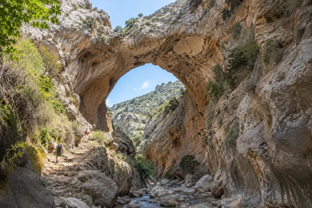
God’s Bridge, also known as Pont de Dieu or Pont d’Allah, is a natural limestone arch spanning a narrow gorge near Akchour.
The usual approach starts from the same general trailhead as the waterfalls but follows a different branch. A commonly mapped out-and-back route is approximately 3–4 km, although extensions and alternative paths can change the distance.
Despite its shorter length, the hike includes steep, rocky sections. The higher approach offers views across the gorge, while lower routes can involve scrambling beside the river. Access to the lower viewpoint depends particularly on water and rock conditions.
Many walkers allow around two hours for the shorter return hike, with extra time for photographs and rest. This is only an estimate, not a guarantee.
Planning advice: Choose God’s Bridge if you prefer a shorter outing but are comfortable with uneven ground and some ascent. Do not assume that walking beside the river is the easier option, especially after rainfall.
4. Jbel Lakraa: Forest Scenery and a Mountain Summit
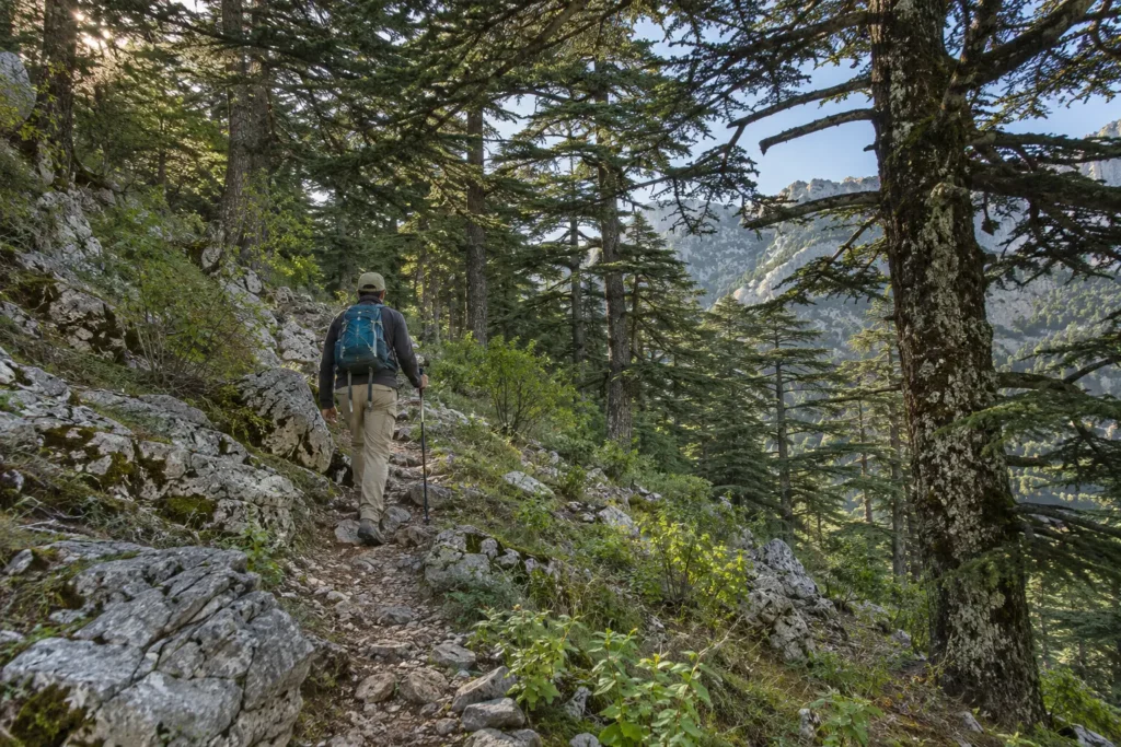
Best for: Fit hikers who want a quieter mountain experience rather than another waterfall walk.
Jbel Lakraa is among the prominent high peaks of Talassemtane, associated with the park’s mountain forests and limestone terrain.
A commonly mapped summit walk is around 9 km, with significant elevation gain. Other approaches may be longer, so the exact trailhead and route should be established before departure.
Compared with Akchour, this outing emphasizes mountain scenery, changing vegetation and elevated viewpoints. The terrain can be rocky, and finding the correct route may be more complicated where paths are faint or intersect with local tracks.
Even if a particular hiking map labels the walk moderate, the ascent, exposure and weather can make it feel considerably harder.
Planning advice: Treat Jbel Lakraa as a dedicated mountain outing. A local mountain guide is strongly recommended for visitors unfamiliar with the route, particularly when visibility or trail conditions are uncertain.
5. Jbel el Kelaa and Jbel Tissouka: Challenging Summit Walks
Best for: Experienced hikers with good endurance who want steep climbs and expansive Rif Mountain views.
Jbel el Kelaa and Jbel Tissouka, sometimes written Tisouka, are well-known hiking objectives in the mountains around Chefchaouen.
Both offer more demanding terrain than the shorter Akchour walks, but they should not be treated as interchangeable routes.
Jbel el Kelaa has hiking approaches associated with Chefchaouen and the surrounding mountain paths. Some mapped circuits involve roughly seven hours of walking, with considerable ascent and descent.
Jbel Tissouka offers another substantial summit challenge. Certain mapped routes require approximately eight hours or more, depending on the approach and walking pace.
These are demanding hiking objectives rather than short sightseeing excursions. Loose stones, exposed slopes, changing visibility and limited route markings can complicate navigation.
Planning advice: Start early, choose one summit rather than attempting both in a rushed day, and confirm the route with an experienced local guide. Build in extra time for rest, navigation and the descent.
6. Afeska to Akchour: A Point-to-Point Trek
Best for: Experienced hikers who enjoy longer routes connecting mountain settlements and valleys.
The Afeska-to-Akchour route offers a different way to experience Talassemtane. Instead of walking out to a waterfall and returning along the same path, hikers travel between locations through the mountain landscape.
Mapped versions of this route can involve several hours of hiking across changing terrain. Navigation deserves particular attention where routes pass through villages, agricultural land or less obvious mountain paths.
The main logistical challenge is that a point-to-point trek does not necessarily end where it begins. Return transport needs to be organized in advance.
Planning advice: Choose this option if the journey between places matters as much as the final destination. A knowledgeable local guide and confirmed transport arrangements make the experience much more practical.
Can You Combine the Akchour Waterfalls and God’s Bridge?
Yes, but combining the two routes creates a significantly longer hiking day than visiting either attraction separately.
The waterfall and God’s Bridge paths branch from the Akchour trailhead. A typical combination involves completing one route, returning toward the junction and taking the other path.
Some mapped combinations covering the upper waterfall and God’s Bridge extend to approximately 14 km. The distance is only part of the challenge: rocky terrain, ascent and possible river crossings all affect the time required.
For a fit walker arriving early in suitable conditions, combining both may be reasonable. For travelers with limited daylight, young children, slower walking speeds or uncertainty about river levels, choosing one main route is more sensible.
If you particularly want to see both, consider spending an additional night in the Chefchaouen area and exploring them on separate days.
Getting to the Hiking Trails from Chefchaouen
Chefchaouen is a practical base for exploring Talassemtane National Park. It offers accommodation and access to several hiking areas, although not every trail begins within walking distance of the town.
Reaching Akchour
Akchour is generally reached by road from Chefchaouen, with the journey often taking around 45 minutes. Actual travel time depends on road conditions, traffic and the departure point.
Visitors can consider:
- Shared grand taxis: A potentially economical option, although departures and return availability should be checked locally.
- A privately arranged taxi: Useful when travelers want to agree on a specific pickup location and return time.
- A rental vehicle: Offers independence, but requires attention to mountain roads and parking arrangements.
- An organized hiking excursion: Convenient for travelers who prefer transport and route guidance to be arranged together.
The main Akchour trailhead is near the dam area, where visitors can choose between the waterfall and God’s Bridge routes. For more destination context, explore the Akchour travel guide.
Reaching the Higher Mountain Trails
Routes toward Jbel Lakraa, Jbel el Kelaa and Jbel Tissouka may use different starting points. Some approaches begin near Chefchaouen, while others require travel to a more distant mountain trailhead.
Confirm the exact starting location before arranging transport. A trail name alone is not enough to determine where a vehicle should drop you off.
For longer or less clearly marked walks, combining local route knowledge with reliable offline navigation is preferable to relying on mobile reception.
When Is the Best Time to Hike in Talassemtane?
Spring and autumn are generally attractive seasons for hiking in the Rif Mountains, but the most suitable period depends on whether you want to explore river valleys or climb higher summits.
Spring: Green Valleys and Flowing Waterfalls
Spring often brings greener landscapes, wildflowers and stronger waterfall flow. Temperatures can be comfortable for longer walks, particularly compared with the hottest summer days.
However, rainfall can also produce slippery trails and swollen streams. A waterfall route that looks straightforward on a map may become unsuitable when crossings are flooded.
Summer: Early Starts and Heat Management
Summer can work for hiking, especially with an early departure and a route suited to the conditions.
Exposed sections may become hot, while higher mountain trails can offer different temperatures from the valleys. Waterfall flow may decrease during drier periods.
Natural pools may look inviting, but do not assume swimming is safe. Assess currents, depth, water temperature and local advice before entering the water.
Autumn: Comfortable Walking with Variable Rain
Autumn can provide pleasant hiking conditions for both gorge walks and mountain routes. Shorter days later in the season make an early start increasingly important.
Rain can return, so check conditions before selecting a river crossing or exposed summit trail.
Winter: More Uncertainty in the Mountains
Winter hiking requires greater flexibility. Rain, wind, colder temperatures and possible snow or ice at higher elevations may affect routes.
Shorter, lower-altitude walks may sometimes be more practical than summit attempts, but conditions still need to be assessed locally. Avoid committing to a difficult mountain route without suitable experience and equipment.
Essential Hiking Preparation and Responsible Travel
Talassemtane’s popular trails may feel approachable, but the park remains a mountain environment. Basic preparation makes a significant difference.
- Wear suitable footwear: Choose hiking shoes or boots with reliable grip for loose stones and wet surfaces.
- Carry enough water and food: Do not depend on refreshment stalls being open throughout the route.
- Prepare for changing weather: Take sun protection, an extra layer and rain protection appropriate to the season.
- Carry navigation tools: Download the intended route for offline use and confirm it matches your starting point.
- Check local conditions: Ask about river levels, damaged paths, weather changes and any current access restrictions.
- Protect the landscape: Stay on established routes where possible, carry rubbish out and avoid damaging vegetation or disturbing wildlife.
- Respect local communities: Ask permission before photographing residents and respect homes, cultivated land and religious spaces.
Be particularly careful around fast-moving water and narrow gorges. Heavy rain upstream can create risks even when conditions at the starting point appear relatively calm.
For remote routes, tell someone your intended itinerary and expected return. A local guide is a sensible choice when the trail is unfamiliar, navigation is uncertain or conditions are difficult.
Common Mistakes When Choosing a Talassemtane Trail
Many disappointing hiking days result from choosing the wrong route for the available time rather than from the scenery itself.
- Assuming all Akchour trails are easy: The shorter river walk is different from the upper waterfall route and the steep approach to God’s Bridge.
- Underestimating the return: Reaching a viewpoint is only part of the hike. Save enough energy and daylight to descend safely.
- Planning several long routes in one day: Road travel, breaks and uneven ground can make an ambitious schedule impractical.
- Using an old route description without checking conditions: Water crossings, trail surfaces and access arrangements can change.
- Choosing a summit solely by distance: Elevation gain, exposure and navigation difficulty can matter more than the number of kilometers.
A better approach is to choose one main hiking objective, identify a shorter fallback option and remain willing to turn back when conditions are unsuitable.
FAQs
Is Talassemtane National Park suitable for beginners?
Yes, some shorter sections near Akchour can suit beginners comfortable walking on uneven ground. The longer waterfall routes, steep gorge paths and mountain summits require progressively more fitness and preparation. Conditions can make even a familiar route difficult.
Do you need a guide to hike in Talassemtane National Park?
Many visitors walk the popular Akchour routes independently in suitable conditions. For higher summits, remote village paths or point-to-point treks, a local mountain guide is strongly recommended. Check current access requirements locally before departure.
Which is easier: God’s Bridge or the Akchour waterfalls?
The shorter walk toward Akchour’s first cascades is generally the more flexible introduction. God’s Bridge is shorter than the full upper-waterfall hike but includes steeper, rockier sections. The upper waterfall demands greater endurance and may involve difficult stream crossings.
Can you explore Talassemtane National Park in one day?
Yes. A day trip from Chefchaouen is realistic for one main Akchour hike, provided transport and conditions are suitable. The higher mountains and longer traverses deserve a separate day or a multi-day itinerary.
Can families hike to the Akchour waterfalls?
Families with children accustomed to outdoor walking may enjoy the shorter river-valley sections. Suitability depends on each child’s abilities, the route and water conditions. Parents should be prepared for uneven footing and should not assume every crossing is safe or accessible.
Choose the Trail That Fits Your Morocco Journey
For most first-time visitors, starting with the Akchour river valley offers the easiest way to discover Talassemtane without committing to a demanding summit. God’s Bridge is a good alternative for walkers who prefer a shorter route with steeper terrain. Jbel Lakraa, Jbel el Kelaa, Jbel Tissouka and longer village routes are better choices when hiking is a main purpose of the trip.
If your schedule allows, spending more time around Chefchaouen gives you flexibility to adjust plans around weather and enjoy both the mountains and the town without rushing. For inspiration beyond hiking, browse more things to do in Morocco.
Travelers who prefer to include a guided mountain experience within a wider itinerary can also explore Visit Morocco Together’s Mountain Adventures and check which routes and arrangements are available for their dates.
The right Talassemtane hike is not necessarily the longest or highest. It is the one that matches your experience, gives you enough time to enjoy the surroundings and leaves room to adapt when mountain conditions change.
Ready to Experience Morocco?
Turn this inspiration into your next adventure. Our travel experts are ready to help.